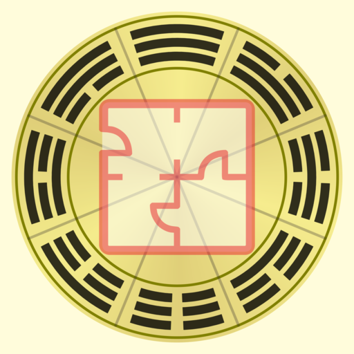
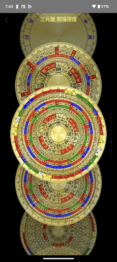
Features FengShui Transparent Compass
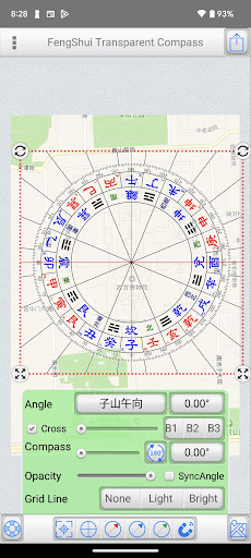
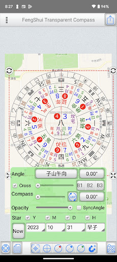
"FengShui Transparent Compass" is a tool used for measuring orientation on "maps" and "house architectural floor plans." It provides various polar scales, acting as a transparent compass overlaid on a map or image to facilitate orientation measurement and Feng Shui assessment.Provides more than a dozen compass face options.File Management: (Offers file management with thumbnail previews to easily manage all manipulated files)Supports Google Cloud Backup and Data Recovery functions (backing up overlay files and settings).Base Maps: ●Map: Capture maps to use as base maps, with three display modes: Normal, Satellite, and Hybrid.
You can also search for addresses (which can be recorded in the current file). ●Album: Choose images from the devices photo album as base maps. ●Camera: Use the camera to take photos and use them as base maps. ●Edit: Crop and rotate base maps.Central Positioning: ●Purpose: Measure the central position of a specific area on the base map. ●Styles: Offers four styles – Crosshair, Nine Palaces Grid, 7x7 Grid, and Polygon. ●Fixed Display: Check to keep it displayed continuously and save the state. ●Operating Steps: ●Place a polygon and align it with a specific area on the base map. ●Adjust its size and rotation freely. ●Tap "Place Polar Scale in Center" to position the polar scale at the center.
Note that the rotation angle does not affect the polar scale; the primary purpose is alignment with the base map. ●Polygon Operation: ●Drag the red dot to align with the measured area. ●Tap on a line and drag to add a new point.
The blue central dot represents the center of the polygon.Polar Scale: ●Adjust the angles of the "Polar Scale" and "Crosshair" to align with the orientation of the buildings on the base map. ●Input angles or use sliders to adjust them. ●Sync Option: ●Map as the base map: Uncheck synchronization since the maps orientation is fixed at True North, and you only need to adjust the crosshair orientation. ●Photo as the base map: Synchronization is automatically checked.
If the bottom is "Zuo Shan" and the top is "Xiang Shan," synchronization is adjusted accordingly.
(Exceptional cases can uncheck synchronization and adjust separately.) ●Transparency: Adjust the transparency of the polar scale based on the base maps color. ●Crosshair: Show or hide the crosshair. ●Gesture Controls: ●Tap the polar scale once to reveal buttons at its four corners. ●Hold the top-left and top-right corners to resize and rotate the polar scale. ●Hold the bottom-left and bottom-right corners to resize the polar scale (use this if you dont want to change the angle). ●Two fingers to zoom in and out. ●You can also share the overlay via Google Cloud Print, WeChat, Line, Messenger, and other platforms depending on device sharing options.Double Star Explanation: ●When using a 1-9 Yun Xuan Kong Flying Star chart, tapping on a palace will display a double star explanation (editable in settings).Auxiliary Lines: ●Offers three auxiliary line colors: Red, Blue, Green. ●Tap the bottom function to display a specific auxiliary line, or uncheck it to hide. ●Methods to adjust auxiliary line angles: 1.From within the polar scale, drag to rotate the auxiliary lines. 2.Use the angle buttons below to input angles. 3.Use the slider below to adjust angles.Magnetic Declination: ●Specify latitude, longitude, and date to obtain magnetic declination from the NOAA website, or manually input magnetic declination. ●You can apply magnetic declination to correct the orientation of the base map.Preferences Settings...● This tool is only an auxiliary tool for Feng Shui identification, and the user needs to have relevant knowledge of Feng Shui.● Operation interface: Traditional Chinese, Simplified Chinese, Japanese, English.● It also supports tablet large screen display in any direction.
Social Features
Connect and share with friends and the community.
Gaming Features
Enjoy immersive gaming experience with various game modes.
Camera Features
Advanced camera features with editing capabilities.
See the FengShui Transparent Compass in Action
Get the App Today
Available for Android 8.0 and above